If you drive an EV in 2025, your charger map app is almost as important as your key fob. With more than 200,000 public charging ports in the U.S. and fast‑charging growing at a record pace, the challenge isn’t whether chargers exist, it’s how to find the right one, at the right time, without getting stranded.
What people mean by “charger map”
Why charger maps matter in 2025
The charger map problem (and opportunity) in numbers
That last number is why using a charger map well really matters. Infrastructure is expanding quickly, but reliability is still uneven. The right map, and the way you use it, can be the difference between a smooth stop and a frustrating detour.
- Turn charger sprawl into an understandable network you can actually use.
- Filter out stations that don’t work for your connector, battery size, or budget.
- Surface high‑reliability locations based on crowdsourced check‑ins and ratings.
- Plan road trips around fast chargers instead of hoping a Level 2 is free when you arrive.
Quick rule of thumb
Types of charger maps and when to use each
Three main kinds of charger maps
Most EV drivers end up using at least two of these regularly.
1. Crowdsourced charger maps
Best for: Real‑world reliability, reviews, photos.
Examples: PlugShare, Chargeway.
These rely on user check‑ins and photos, so they’re often the first to flag broken hardware or parking hassles.
2. Network‑specific maps
Best for: Brand‑loyal charging (e.g., Electrify America, Tesla).
Examples: Electrify America, EVgo, Tesla, ChargePoint apps.
Great for status accuracy and pricing, but you’ll only see that one network.
3. Integrated navigation & planners
Best for: Road trips and automatic route planning.
Examples: A Better Routeplanner (ABRP), in‑car route planners, Google Maps EV mode.
They optimize stops around your battery size, state of charge, and weather, then overlay chargers along the way.
Why you may need more than one map
Top EV charger map apps compared
There are dozens of apps that call themselves a charger map. A handful dominate in the U.S. because they either have the best station coverage, the best route planning, or both. Here’s how the major options stack up.
Popular charger map apps at a glance
Think of this as a starting point, most drivers will mix and match based on where they live and which EV they own.
| App | Primary strength | Best for | Key limitations |
|---|---|---|---|
| PlugShare | Crowdsourced reliability data | Anyone who wants to avoid broken or ICEd stations | Interface can feel busy; planning tools are basic. |
| ChargePoint | Strong Level 2 coverage + access card | Workplace and destination charging | Focuses heavily on its own network; less DC fast depth than pure planners. |
| Electrify America | Live fast‑charger status + pricing | Non‑Tesla road‑trippers on EA corridors | Limited to one network; some reliability complaints. |
| EVgo | Urban DC fast charging focus | City drivers who need quick top‑ups | Coverage still patchy outside metro areas. |
| Tesla app / in‑car map | Tight integration with battery management | Tesla drivers (and some non‑Teslas at open sites) | Full trip planning still Tesla‑centric; not all sites open to every brand yet. |
| A Better Routeplanner (ABRP) | Deep route planning & battery modeling | Long‑distance drivers and data nerds | Learning curve; best used alongside a network app. |
| Google Maps / Apple Maps | Familiar interface + POIs | Quick “near me” searches and one‑off stops | Connector details and live status can lag behind dedicated apps. |
App features can change quickly, so always check the latest version notes before a long trip.
A solid starter setup
How to read a charger map like a pro
1. Start with the right filters
- Connector type: NACS, CCS, J1772, CHAdeMO, filter out anything your car can’t use.
- Charging speed: For road trips, prioritize DC fast (50 kW+) over Level 2.
- Network: If you have a membership or perks (EA, EVgo, Tesla), surface those first.
- Access hours: 24/7 vs. “during business hours only,” especially at dealerships or workplaces.
2. Then check “soft” data
- Recent check‑ins: A station with check‑ins in the last few days is usually safer than one with none for months.
- Star ratings & reviews: Look for patterns, multiple “always broken” or “blocked by gas cars” comments are a red flag.
- Photos: Helpful to find chargers in confusing parking lots and confirm that signage and lighting are OK.
- Parking rules: Notes about paid parking, time limits, or overnight restrictions can save a ticket.
Quick checklist before you navigate to a charger
Confirm your connector is supported
Double‑check that the charger shows the connector you need (for many new EVs, that’s CCS or NACS). If you rely on an adapter, make sure that’s allowed and physically fits.
Check live status, then recency
Use the network app to confirm stalls are online, then look at PlugShare or similar to see if people have charged there successfully in the last week.
Scan reviews for patterns
One negative review is noise. Three reviews complaining about the same issue (offline, blocked, slow) is a sign to pick a backup.
Look at amenities and safety
Late‑night stop? Favor chargers with lighting, cameras, and restrooms. Charger maps often include these details, but user photos tell the real story.
Save at least one backup nearby
On any new route, star or favorite a second station within 10–15 miles in case your first choice is down or overcrowded.
Planning road trips with charger maps
Road trips are where a good charger map really earns its keep. Instead of just asking “Where’s a charger near me?”, you’re asking “How do I get from A to B as fast and stress‑free as possible, given my battery and the weather?” That’s a different problem, and the best route planners treat it that way.
Two main ways to use charger maps on trips
Both approaches work; pick the one that matches how hands‑on you want to be.
Let the planner do the work
Tools: Your car’s built‑in route planner, A Better Routeplanner, or Google Maps EV routing.
- Input your destination, current state of charge, and preferred arrival buffer.
- Let the app choose stops based on elevation, temperature, and traffic.
- Use a second map (like PlugShare) to sanity‑check each stop before you hit the road.
Hand‑craft your route
Tools: PlugShare trip planner, ABRP in advanced mode.
- Lay out key cities or highways you want to travel through.
- Drop pins at fast‑charging hubs with amenities you like.
- Build contingency stops into the plan so you’re never forced to roll into a station at 1–2% battery.
Watch those last 10%–15%
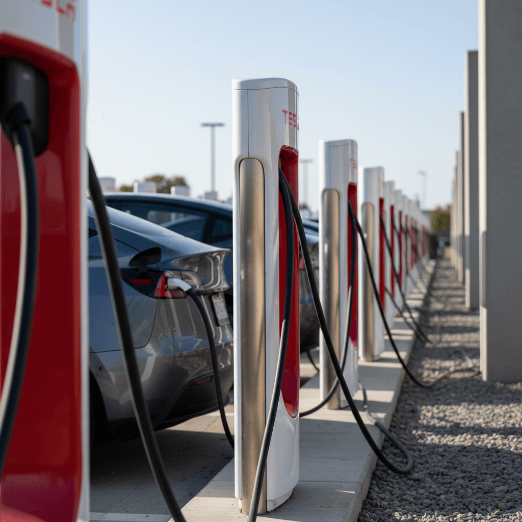
Tesla Supercharger maps and non-Tesla access
If you drive a non‑Tesla, the phrase “Tesla Supercharger map” has a different weight than it did even a couple of years ago. By mid‑2025, thousands of Supercharger stalls across more than two dozen states are open to non‑Tesla EVs through Magic Dock hardware or NACS compatibility, and your charger map needs to know which is which.
Using Tesla’s own map
- Tesla app filter: In the Tesla app, use filters like “Open to non‑Tesla” to show only compatible Superchargers.
- In‑car nav (Tesla owners): Automatically routes via Superchargers and preconditions the battery for faster charging.
- Site details: Tap a site to see max kW, number of stalls, amenities, and any access notes.
Using third‑party charger maps
- PlugShare layers: Look for Supercharger icons and read notes on non‑Tesla access (Magic Dock vs. NACS required).
- Connector filters: Filter for NACS where your EV supports it, or for CCS if the site has built‑in adapters.
- Route planners: Apps like ABRP increasingly recognize Superchargers as options for compatible non‑Teslas.
Check access before you count on a Supercharger
Avoiding common charger map pitfalls
Even seasoned EV drivers get tripped up by charger maps now and then. Much of it comes down to treating the map as perfect truth instead of what it really is: a powerful, but imperfect, data layer on top of a messy real‑world network.
Common mistakes, and how to avoid them
Relying on outdated data
A station that looks fine on the map may have been offline for weeks. Sort by most recent check‑ins or reviews, and avoid locations with long gaps in activity.
Ignoring power ratings
Two “fast chargers” on the map can be very different. A 50 kW unit might be fine for a coffee stop; a 350 kW unit is better when you’re in a hurry and your car can accept it.
Forgetting about site‑level reliability
If a plaza has eight chargers but reviews talk about grid problems or repeated outages, treat it as higher risk and star a backup nearby.
Not checking access rules
Charger maps may not fully capture parking rules. Look for notes about garage hours, hotel guest‑only access, or paid parking during events.
Planning to arrive nearly empty
Mapping apps sometimes optimize for speed, not comfort. Give yourself a buffer, aim to reach each stop with 10%–20% remaining instead of single digits.
Don’t navigate blindly
How charger maps fit into buying a used EV
Charger maps aren’t just for current owners; they’re a smart research tool when you’re considering a used EV, especially if you’re moving from a gas car and aren’t sure what charging will feel like day‑to‑day.
Use a charger map to “live” with the car before you buy
- Drop a pin at your home and workplace and look at nearby Level 2 and DC fast options.
- Simulate your weekly routine, commute, errands, weekend trips, and see where you’d realistically charge.
- Pay attention to connector availability for the specific model you’re considering (CCS vs. NACS, adapter support, legacy CHAdeMO, etc.).
How Recharged helps connect the dots
At Recharged, every used EV comes with a Recharged Score Report that shows verified battery health and realistic range. When you pair that with local charger map data, you can answer questions like:
- “With this car’s battery health, are the chargers near me enough for winter commuting?”
- “Do I need fast charging nearby, or will a home Level 2 cover almost everything?”
- “Does the connector standard on this car match the infrastructure where I actually drive?”
If you’re unsure, Recharged’s EV specialists can walk you through real‑world charging scenarios using your home ZIP code and typical driving patterns.
Turn maps into confidence
Charger map FAQs
Frequently asked questions about charger maps
Key takeaways on charger maps
A charger map is more than dots on a screen, it’s your interface to a rapidly growing but still imperfect charging network. Used well, it helps you avoid broken hardware, plan realistic routes, and match the EV you own (or are considering) to the infrastructure you actually have access to.
- Use at least two tools: a planning app or in‑car nav plus a crowdsourced map for reality checks.
- Always filter by connector type, charging speed, and access hours before you start driving.
- Treat reviews, check‑ins, and photos as your early‑warning system for unreliable locations.
- Build in backup stations on new routes, especially in regions with sparse infrastructure.
- When shopping for a used EV, combine charger maps with a Recharged Score Report so you know how battery health and local charging options will work together in the real world.